

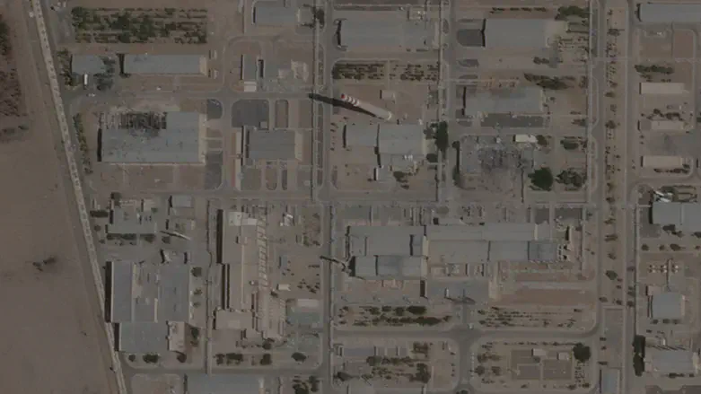
High-resolution satellite imagery of Iran's Isfahan nuclear complex, taken on Sunday and published on Monday by the Institute for Science and International Security, reveals significant changes around the site’s tunnel entrances.
The images show that the middle and southern entrances have been completely covered with soil, making them unrecognizable. The northernmost entrance, which features additional passive defense measures, has also been backfilled with soil.
The Institute for Science and International Security said that the alterations suggest Iran is taking steps to protect the facility from potential US or Israeli aerial strikes or ground raids. It noted that backfilling the tunnels would dampen the effects of airstrikes and complicate special forces operations intended to seize or destroy sensitive materials, such as highly enriched uranium, that may be stored in the tunnels. While it cannot be confirmed, it is possible that Iran has moved equipment or materials into these tunnels for protection, said the organization.
It also noted that similar preparations were observed just before Operation Midnight Hammer this past June, in which the US joined Israel and struck the nuclear facilities at Fordow, Natanz, and Isfahan.
This past Friday, The Associated Press published satellite images which show activity at two Iranian nuclear sites bombed last year by Israel and the United States that may be a sign of Tehran trying to obscure efforts to salvage any materials remaining there.
The images from Planet Labs PBC show roofs have been built over two damaged buildings at the Isfahan and Natanz facilities, the first major activity noticeable by satellite at any of the country's stricken nuclear sites since Israel's 12-day war with Iran in June.
Those coverings block satellites from seeing what's happening on the ground, right now the only way for inspectors from the International Atomic Energy Agency (IAEA) to monitor the sites as Iran has prevented access.