
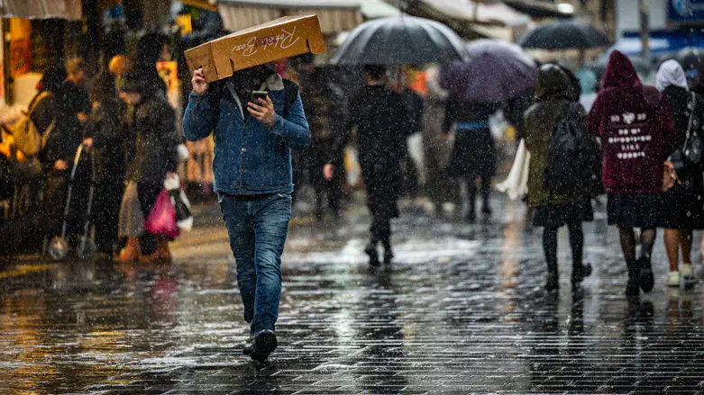
Meteorologist Lior Sudri published a wintery forecast this morning (Sunday), warning of a significant drop in temperatures, intermittent rainfall, and a risk of flooding and flash floods.
According to the forecast, today will be cloudy and colder than usual. Intermittent rain is expected in northern and central Israel, occasionally accompanied by thunderstorms. Snow is expected on Mount Hermon. There is a slight risk of flooding in coastal cities and the Shfela region, as well as flash floods in the Jordan Valley.
From the afternoon hours, the rain is expected to spread to the northern Negev, with a risk of flash floods in the Judean Desert and the Dead Sea area.
In the Mediterranean Sea, south-easterly to south-westerly winds will blow at speeds of 15-30 km/h, with gusts reaching up to 50 km/h. Sea conditions will range from moderate to rough, with wave heights of 60-180 cm.
On Monday, the weather will be partly cloudy and cold. Light local rain may occur in the morning, mainly in central Israel and the Negev. Overnight, skies will clear and it will be very cold, with a risk of frost in the Golan Heights and the northern valleys.
On Tuesday, conditions will be clear to partly cloudy. Temperatures will remain colder than seasonal norms. At night, the risk of frost will continue in areas prone to it.
On Wednesday, temperatures will rise slightly, mainly along the coast and in the Shfela. Skies will be partly cloudy with high and mid-level clouds, and dry conditions will persist. Strong easterly winds will blow in northern Israel and in the mountains.
On Thursday, it will remain partly cloudy with mid- and high-level cloud cover. Temperatures will rise noticeably and be slightly above the seasonal average. Strong easterly winds will continue inland and in mountainous areas, and light local drizzle is possible.