
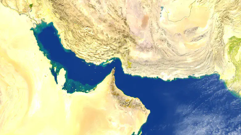
Iran’s newly formed "Persian Gulf Strait Authority" (PGSA) issued a map on Wednesday delineating what it boldly claimed is its sovereign "controlled maritime zone" within the strategically critical Strait of Hormuz.
In a post on social media, the maritime body published the precise coordinates of its self-proclaimed blockade zone. The PGSA defined the territory as the "line connecting Kuh Mobarak in Iran and the south of Fujairah in the UAE in the east of the strait to the line connecting the end of Qeshm Island in Iran and Umm al-Qaiwain in the UAE in the west of the strait."
The regime's new agency went on to issue an explicit ultimatum to the international commercial fleets navigating the vital shipping lanes, warning that any vessel entering the perimeter for the purpose of passing through the strait "requires coordination with, and authorization from" the PGSA.
The move marks a major escalation in Tehran's ongoing maritime brinkmanship. Earlier this month, the regime officially rolled out the domestic PGSA apparatus, claiming its primary purpose is to coordinate directly with international shipping conglomerates to extract mandatory passage fees from merchant vessels.
Accompanying the bureaucratic rollout, Iran has issued multiple direct threats to launch military strikes against any international cargo ships attempting to navigate the strait without obtaining its explicit permission.
Shortly after Israel and the US launched joint strikes on Iran on February 28, Iran declared the Strait "closed".
The United States has countered with a comprehensive naval blockade, effectively severing maritime access to and from Iranian ports.