
Steven Teplitsky is the creator and publisher of The Witness Ledger substack. The Witness does not predict the future. She remembers the past. Original visual essays on politics, history, memory, and recurring human folly.
Diplomacy has an enduring, almost sentimental habit of mistaking treaty paper for the permanent contours of the human landscape.
For the better part of a century, generation after generation of Western diplomats looked at the map of the modern Levant and saw what they believed was an established, enduring reality: Lebanon, Syria, Jordan, and Israel. Independent flags. Sovereign republics. Permanent borders.
It was never anything of the sort.
The present map was assembled from the wreckage of the Ottoman Empire, drawn by European civil servants attempting to convert centuries of shared markets, shifting provincial boundaries, sectarian communities, and competing claims into something resembling a modern political order.
To understand the perpetual unraveling of the eastern Mediterranean, one must look beyond the post-1920 frontiers and examine the older geographic baseline that preceded them: Bilad al-Sham.
The Shattered Continuum
Before 1920, the Levant was not a fractured cluster of competing sovereign flags. Under the Ottoman Empire, the region was governed through an evolving collection of provinces and districts-vilayets and sanjaks-whose boundaries shifted with the administrative needs of Constantinople, bearing little resemblance to the international lines that followed the First World War.
The organizing idea of Bilad al-Sham was older still.
Centuries before the Ottomans, under the early Islamic administrative order, the Levant was divided into military-administrative sectors known as ajnad. Their borders evolved over time, but their underlying geography cut directly across the national boundaries familiar to us today:
Dimashq (Damascus): Centered on the ancient inland capital, this district swept across the mountain spine to encompass the Mediterranean coast-including Baalbek, Beirut, Sidon, and Tyre. Planners viewed Damascus and the coastal ports as parts of a single, indivisible economic system.
Al-Urdunn: Centered at Tabariyya-modern Tiberias-this sector formed the strategic inland-to-coastal hinge, binding the Galilee, the Golan Heights, and the northern reaches of modern Jordan directly to Mediterranean outlets like Acre and Tyre.
Filastin: Covering the southern expanse, linking Jerusalem, Ramla, Nablus, Jaffa, and Gaza, stretching toward the approaches to the Sinai.
There is a vital historical reality here that modern politics has largely obscured:
Filastin was never conceived as a sovereign state, a distinct national homeland, or an independent political entity.
Throughout Islamic and Ottoman history, Jund Filastin-and later the southern Ottoman sanjaks-functioned strictly as administrative and fiscal subdivisions. It was a regional tax-collection district, drawn for bureaucratic convenience, military logistics, and agricultural revenue extraction. Residents did not view themselves as citizens of a sovereign country called Filastin; they were subjects of the reigning empire, culturally embedded in the wider Syrian geographic fabric.
These were not static nation-state lines. They were ledger lines in an imperial tax registry.
The Day the Map Was Cut
In September 1920, on a shaded veranda in Beirut, the French High Commissioner, General Henri Gouraud, proclaimed the creation of “Greater Lebanon."
France annexed the fertile Bekaa Valley, Tripoli, and the coastal ports to carve out a protected, Christian-dominated enclave, detaching them from the Syrian interior. South of the French line, the British established their own mandate over Palestine and drew the borders of Transjordan across the desert.
London and Paris hailed this as the triumph of modern statecraft. Damascus saw it as an amputation.
Historic trade routes were severed by international customs posts. Major seaports that had sustained the interior for centuries suddenly belonged to a separate, foreign-aligned republic. The status quo was shattered, and the refusal to accept that partition became the animating principle of Syrian statecraft for the next hundred years.
The Double Rejection
Nowhere was this refusal to accept the post-1920 settlement more consequential than in Syria’s posture toward the State of Israel-and toward the Palestinian Arabs.
Damascus viewed the establishment of Israel in 1948 across the historic sectors of Filastin and al-Urdunn as an existential wedge. It planted a powerful adversary squarely across territory Syrian nationalists considered historical Syrian soil and severed the old overland connection toward Egypt. Then, in 1967, Israeli forces captured the Golan Heights, placing Israeli military power on the strategic plateau overlooking the approaches to Damascus.
Yet Western observers routinely misunderstood the corollary. The rejection of Israel did not mean Damascus embraced an independent Palestinian state.
Because Filastin had never been a distinct sovereign nation in the regional imagination, Damascus viewed the territory exclusively as Suriyya al-Janubiyya-Southern Syria. To Syrian statecraft, creating a sovereign, independent Palestinian state was almost as problematic as an Israeli state, because it would permanently codify the colonial partition of Greater Syria and turn an administrative tax district into a permanent foreign border.
Consequently, Damascus spent decades manipulating, splintering, and suppressing autonomous Palestinian Arab factions. Yasser Arafat and the PLO were supported when their operations served Syrian strategy, and targeted when they attempted to act independently. Syria treated "Palestine" not as a sovereign partner, but as an operational card to be played from Damascus.
In Lebanon, the border was simply ignored. For nearly thirty years, Syrian military intelligence governed Lebanese political life from a walled headquarters in the border town of Anjar-vetting cabinets, selecting presidents, and reminding Beirut that its sovereignty was entirely conditional.
The Imperial Handover
The collapse of the Assad dynasty in December 2024 ended more than half a century of family rule, but it brought no sovereign restoration.
The transitional authority in Damascus under Ahmed al-Sharaa inherited an insolvent treasury, fractured state institutions, and an army in ruins. Incapable of sustaining domestic order alone, Damascus turned to the regional power best positioned to fill the vacuum: Turkey.
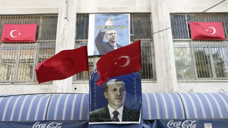
President Recep Tayyip Erdoğan’s foreign policy is driven by a clear neo-Ottoman strategic vision, reviving the historical memory of the Misak-ı Millî, or National Pact.
Ankara does not need to formally annex Syrian territory or raise Turkish flags over Damascus. Modern spheres of influence operate through more sophisticated instruments: military training and security cooperation, weapons and logistical support, electricity and energy links, reconstruction contracts, trade, investment, and political patronage. The border need not move when dependency can accomplish the same strategic purpose.
For a century, Damascus resisted the political order imposed upon Bilad al-Sham by outside powers. Now Damascus itself must operate beneath the shadow of one.
The historical asymmetry is unmistakable. The Syrian state that once sought to dominate Lebanon and control the southern Levant has become an administrative satrapy dependent on a far more powerful empire to its north.
The Gathering Shadow
There is an understandable temptation in Western capitals to view this simply as the stabilization of Syria within its familiar international borders.
That assumes the borders themselves explain the strategic reality. They do not.
By securing Damascus, Turkey commands the geographic spine of the Levant-running south from Anatolia through Aleppo, west to the Mediterranean, and down toward the transit corridors of Jordan and the Arabian Peninsula.
Jerusalem watches this northern expansion with deep apprehension, recognizing a major regional power embedding itself on its northern horizon. Jordan watches its northern trade gate fall under new patronage. Lebanon sits exposed on an unstable periphery.
A century after European cartographers divided the historic space of Bilad al-Sham, no one needs to formally abolish the post-WWI borders to dismantle them. The embassies remain open. The flags still fly.
The question is no longer where the lines were drawn. It is who, in the end, has the power to make those lines matter.
If you’re saying, “I didn’t know that," then now you know the whole story.