Several tsunami waves hit the northeastern coast of Japan on Monday night (early Tuesday morning local time), following a 6.9 magnitude earthquake that hit the region, AFP reports.
Japanese authorities issued a tsunami warning for the region's coast including Fukushima prefecture, where a 9.0-magnitude earthquake and 23-foot tsunami hit in 2011.
The biggest tsunami to hit the region so far measured 90 centimeters (three feet), public broadcaster NHK reported.
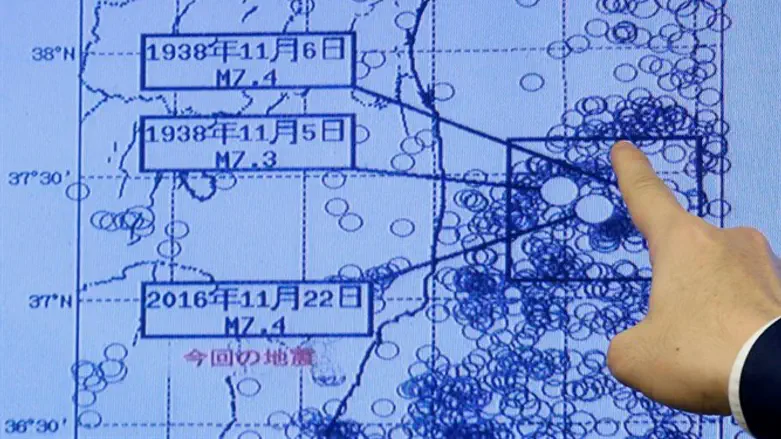
The United States Geological Survey (USGS) said the 6.9 magnitude quake, at a shallow depth of 11.3 kilometers (seven miles), struck shortly before 6:00 a.m. Tuesday morning Japan time in the Pacific off Fukushima, according to AFP.
Japan's meteorological agency had earlier estimated the quake's magnitude at 7.3.
While the quake also shook buildings in Tokyo, there were no immediate reports of damage or injuries.
Initial reports said there appeared to be no significant damage to the Fukushima nuclear plant, which was shut down several times following the 2011 earthquake.
Japan sits at the junction of four tectonic plates and experiences a number of relatively violent quakes every year.
In April, two strong earthquakes hit southern Japan's Kumamoto prefecture followed by more than 1,700 aftershocks, leaving at least 50 dead and causing widespread damage.
An announcer on public broadcaster NHK urged residents along the coast to move to high ground following the latest earthquake.
"Please flee immediately," the male voice said, with great urgency.