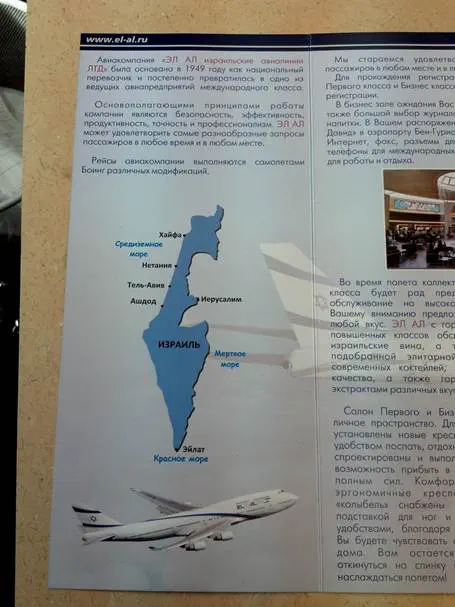
An El Al brochure distributed to tourists features a map of Israel inside its 1948 armistice borders. The brochure is distributed to tourists from Russia, and shows the areas of Judea, Samaria, and the Golan, liberated in the 1967 Six-Day War, as outside the borders of the country.
The brochure has caused much distress among many tourists and Israelis who have seen it, with several attributing the map to a political stance on the part of the company, something that many Israelis in the center and right of the political spectrum say they are very uncomfortable with. A blogger (“Skopia”) from the Rotter.net site contact Arutz Sheva and posted photos of the map on Facebook and other forums, which generated many negative comments about El Al in a number of internet forums, and on the El Al Facebook page.
Arutz Sheva contacted El Al on Wednesday, seeking an explanation for the map's presence in the brochure. A spokesperson for the company said they would investigate, and some time later, a message appeared on El Al's Facebook page with an explanation: “We wish to clarify regarding the photos that all official El Al maps show Israel in its 'official' borders. An initial investigation into this incident indicates that the brochure is not an official El Al brochure, and it is not distributed as such. We will continue to investigate the issue.”
Despite El Al's clarification, many Israelis continued to express anger over the map, and said that the evidence indicated that the brochure was indeed distributed by El Al, since there are photos of El Al planes in it, and it lists El Al's official Russian-language site. Arutz Sheva will continue to follow this story.