
The Intelligence Corps' Unit 9900 is participating in the IDF's mission to rescue survivors trapped under rubble following the devastating earthquakes which struck Turkey and Syria this week.
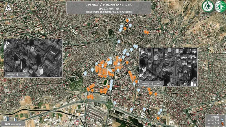
The unit assists in deciphering satellite photographs, which allows the forces in the field to pinpoint the location of collapsed buildings and thus optimize their work.
Yesterday a special team from the mapping unit landed in Turkey. The unit uses advanced technological capabilities in the field which are a force multiplier for the branch of the Home Front Command that deals with field analysis.
The commander of the dedicated mapping team in Unit 9900, Lieutenant A, said: "I am proud to take part in the Israeli effort to save lives in Turkey. We are using mapping capabilities that are usually used for special operations to save lives wherever needed."
So far, the Home Front Command mission has rescued 17 civilians alive from under the rubble.
Meanwhile, the number of people killed in the earthquake in Turkey and Syria rose to 19,850 people. Turkish President Erdogan spoke in the Kilis Province and said that "Turkey is facing the greatest earthquake disaster the region has ever known."
The Turkish Disaster Agency said that the search and rescue operations were completed in two of the 10 districts affected by the earthquake - Kilis and Sanliurfa.